Rwanda is among the fastest growing countries in sub-Saharan Africa. Even with this breakneck pace of economic expansion, over 70% of the population makes a living from subsistence agriculture and natural resources like forests and rivers.
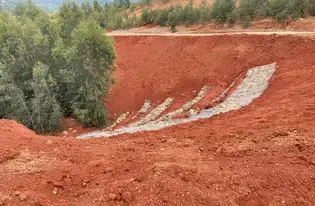
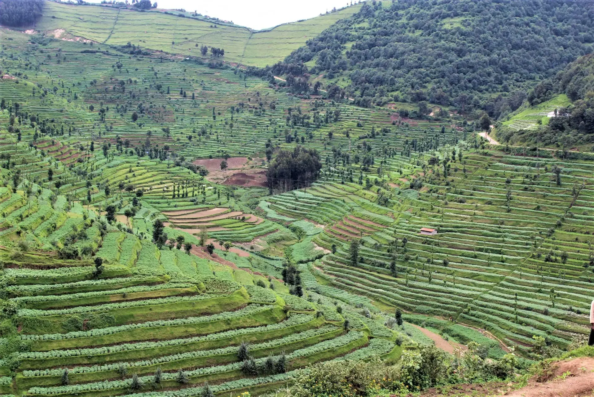
Intense farming on Rwanda’s hilly landscapes and fragile soils has had a profound impact on the health of the land and the communities that call it home. And because 85% of rural people depend on biomass like charcoal for cooking, deforestation has been on the rise as people search farther and farther for wood. As a result, much of the steep land is bare. Every time the rains come, more and more topsoil is washed into the river, creating deep, rocky gullies. The resulting landslides don’t only wipe out farmers’ fields; they threaten people’s lives, too.
The problem is especially severe along the Sebeya River, which originates in the mountains of Rutsiro District in Western Rwanda. The river flows for over 110 kms and has a catchment area of 286 km2, spanning the districts of Rutsiro, Ngororero, Nyabihu and Rubavu.
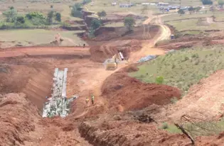
As a result of poor agriculture practices, deforestation and unsustainable mining upstream, hundreds of people in Rubavu have been displaced and communities massively overwhelmed by river flooding over the past twenty years.
To help address these challenges, the International Union for Conservation of Nature (IUCN) in collaboration with Government of Rwanda’s Water Resources Board and the Netherlands Development Organization (SNV) are working to reverse that damage through 2022. So far, nearly 2,400 ha are under restoration. Together, they are working with local communities throughout the country to help people sustainably manage their natural resources across entire landscapes. Their work in the Sebaya catchment and its neighboring areas is transforming livelihoods and the land.
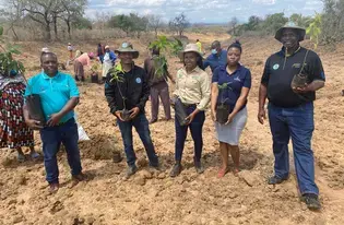
The project aims to restore landscape in the upper Sebeya River through reforesting the land, encouraging farmers to grow trees on their land in agroforestry systems, and promoting climate-smart agricultural practices. Their goal is to improve livelihoods and better protect Rwanda’s natural resources.
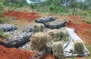
IUCN is providing technical assistance across four administrative districts (Rubavu, Nyabihu, Rutsiro, and Ngororero). The project’s people-centered approach has helped communities in Sebeya design and execute the restoration techniques that help them meet their own goals. Technical support staff embedded in the communities also work every day to mobilize and engage women and men to terrace the steep hillsides to prevent erosion, fill in small gullies, and plant tree species that farmers want on their cropland.
The communities are also building small dams and digging trenches to better regulate the flow of water in their landscape. By combining these techniques and preventing cattle from grazing in the newly restored area, the river is now regaining its health. Even during the COVID-19 economic crisis, the project has employed over 15,000 local people to fight the floods.
By scaling up this work in the coming years, the communities and IUCN are working to realize a vision of Rwanda’s future that is full of healthy forests, woodland, rivers, wetlands and farmland.